


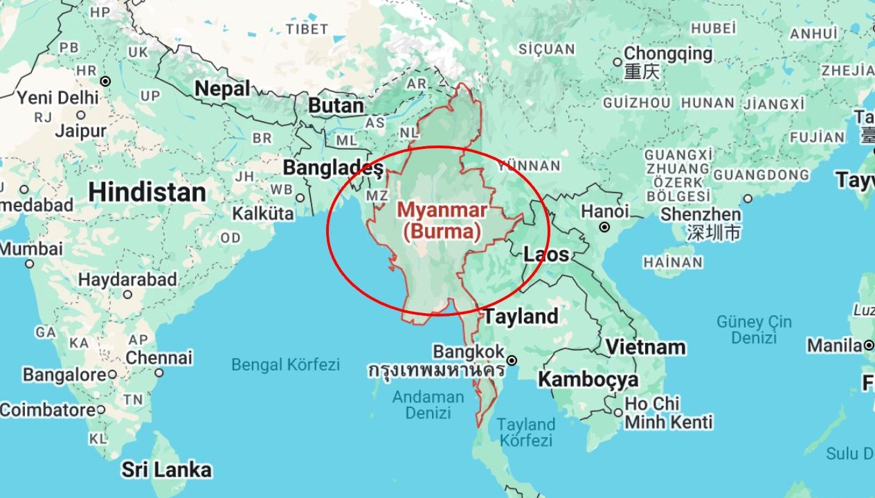
The location of Myanmar has become a topic of curiosity and research among social media users. Following the 7.7 magnitude earthquake in Myanmar, questions about the country’s position and place on the map have arisen. So, where is Myanmar located? Here is the position and map of Myanmar. Myanmar is an independent country located in Southeast Asia. It shares borders with China, India, Bangladesh, Laos, and Thailand. The country has coastlines on the Bay of Bengal and Andaman Sea in the south. It gained independence from England on January 4, 1948. Formerly known as Burma, the country officially adopted the name Myanmar in 1989. The capital of Myanmar is Naypyidaw, with the largest and most developed city being Yangon. Cities like Mandalay and Bagan hold historical and cultural significance. Myanmar is one of the largest countries in Southeast Asia, covering an area of 676,578 square kilometers. It shares borders with Bangladesh and India to the west, China to the north, and Laos and Thailand to the east. Myanmar is famous for its historical structures and natural beauty. Bagan Ancient City, listed on the UNESCO World Heritage List, is one of the country’s most touristy sites. Myanmar is also known for being one of the countries where Theravada Buddhism is most prevalent, hosting numerous ancient pagodas.

Magazines cover a wide array subjects, including but not limited to fashion, lifestyle, health, politics, business, Entertainment, sports, science,


Comments are closed