


Specialists who examined the earthquake that devastated Asia explained the factors leading to the disaster in detail.
Experts analyzing the tremors that caused a 7.7 magnitude earthquake in Myanmar, affecting China and Thailand as well, predicted that the death toll would reach tens of thousands. Scientists provided a detailed explanation of the reasons behind the seismic activity resulting in such a significant impact. They stated that the devastating earthquake occurring in Myanmar is the most powerful one to hit the country in decades, and disaster modeling indicates the potential death toll could be significant.
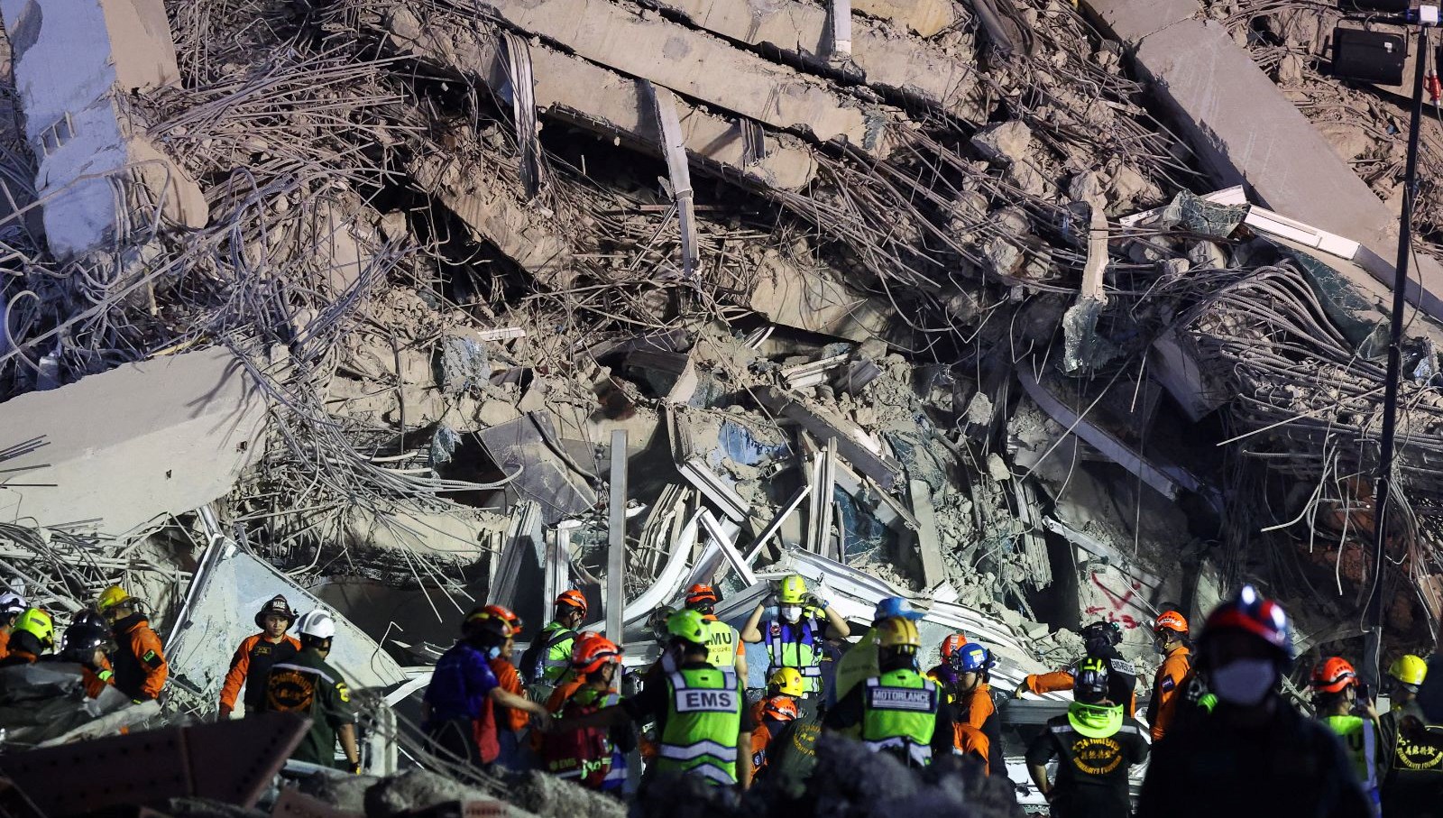
The United States Geological Survey (USGS) reported that the 7.7 magnitude earthquake in the central region of Sagaing in Myanmar triggered a red alert for earthquake-related deaths and economic losses. The epicenter of the earthquake near the Mandalay city in the central parts of Myanmar, where over a million people reside, indicates high casualties and extensive damage. The statement mentioned, “High casualties and extensive damage are likely, and the disaster is likely to be widespread.”
This morning, Myanmar’s ruling junta announced that the death toll has exceeded a thousand, with over two thousand injured. However, the USGS analysis indicated a 35% probability of the possible death toll ranging from ten to one hundred thousand people.
Warning of potential material damage possibly exceeding billions of dollars, the USGS suggested that it could surpass Myanmar’s GDP. Bill McGuire, a retired professor specializing in geophysics and climate hazards at University College London (UCL), mentioned that minutes after the initial earthquake, an aftershock of 6.7 magnitude occurred, indicating the possibility of more to follow. Rebecca Bell, a tectonic expert at Imperial College London (ICL), proposed the occurrence as a “strike-slip fault” along the Sagaing Fault.
This fault zone is where the western Indian tectonic plate meets the Sunda plate, which constitutes a large part of Southeast Asia, akin to the San Andreas Fault in California in scale and movement. Bell explained, “The Sagaing fault is very long, 1200 kilometers, and very straight. The fault’s straight structure implies that earthquakes can occur over wide areas, with the size of the fault slip area correlating to the magnitude of the earthquake.”
Emphasizing the potentially destructive nature of such events, Bell added that due to the shallow depth of the earthquake, its seismic energy had little dispersion when it reached densely populated areas, resulting in extensive surface vibrations. Myanmar has a history of powerful earthquakes.
Brian Baptie, a seismologist from the British Geological Survey, stated that in the last century, over 14 earthquakes of magnitude 6 and above, including a 6.8 magnitude quake near Mandalay in 1956, occurred in the region. Ian Watkinson from the Earth Sciences Department at Royal Holloway University of London highlighted that a notable change in recent years has been the “boom in reinforced concrete high-rise buildings.”
He pointed out that Myanmar has been rocked by years of conflict, with low levels of sanctions on building designs. Watkinson noted, “Criticality, during previous 7 or higher magnitude earthquakes along the Sagaing Fault, Myanmar was relatively underdeveloped, consisting mainly of low-rise wooden structures and brick-built religious monuments.”
“This earthquake serves as the first test for modern Myanmar’s infrastructure against a major, shallow-focused tremor near densely populated large cities,” he added. Baptie stated that at least 2.8 million people in Myanmar reside in the most earthquake-affected areas, living in vulnerable structures consisting of wooden and unreinforced brick walls.
Ilan Kelman, a disaster reduction expert at UCL, underlined the customary saying that “earthquakes don’t kill people, collapsing infrastructure kills people.” He stressed that governments are responsible for planning regulations and building codes, adding, “This disaster highlights what the Burma/Myanmar governments failed to do well before the earthquake and during the tremors, which could have saved lives.”
In neighboring Thailand, severe tremors also occurred resulting in a 30-story high-rise building under construction turning into a dusty concrete heap, trapping workers under the rubble. Christian Malaga-Chuquitaype from ICL’s Department of Civil and Environmental Engineering pointed out that despite being approximately 1000 kilometers away from the epicenter in Myanmar, Bangkok’s ground structure contributed to the impact on the city.
He stated, “Although Bangkok is distant from active faults, its soft ground intensifies the tremors, particularly affecting tall buildings during distant earthquakes.” Malaga-Chuquitaype highlighted that construction techniques in Bangkok favoring “flat slabs” – designed without reinforcing beams and mainly supported by columns akin to legs holding up a table – are problematic.
He mentioned that the initial video analysis of the collapsed tower block in Bangkok showed the usage of such construction techniques that tend to perform poorly during earthquakes, often being brittle and somehow collapsing. Roberto Gentile, a disaster risk modeling expert from UCL, suggested that the “dramatic collapse” of the tower block in Bangkok may necessitate a comprehensive evaluation of other tall buildings in the city.
Following over two thousand damage reports, Bangkok city officials announced the deployment of over a hundred engineers to inspect buildings for safety.


Comments are closed